Relief map print · Bannau Brycheiniog
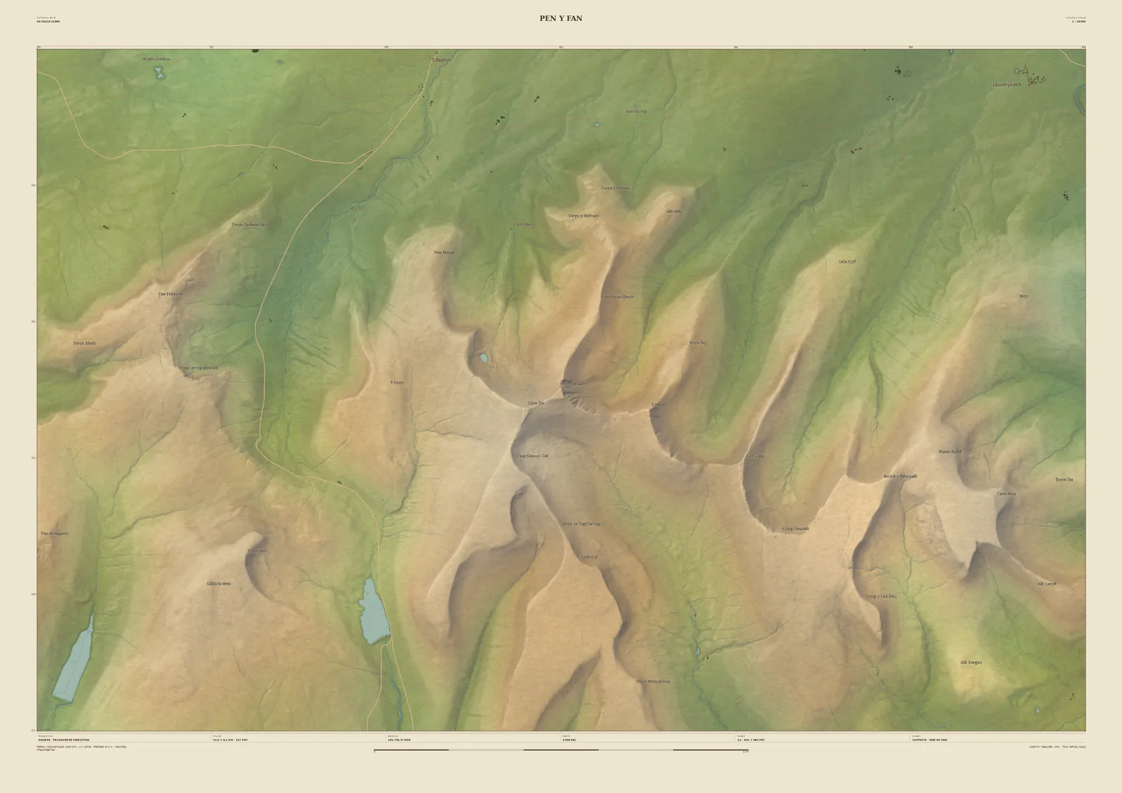
Pen y Fan relief map print
The roof of southern Britain and its long north-facing ridges
Pen y Fan is the highest point in southern Britain, the top of the escarpment in Bannau Brycheiniog (the Brecon Beacons). Seen from above, the range is a row of steep north faces with long, smooth ridges running down from them. Corn Du and Cribyn stand either side of the summit, and reservoirs lie in the valleys to the west.
It’s drawn from the Welsh Government’s 1-metre LiDAR, which catches the sharp edge of the escarpment and the small streams cutting into its slopes. It suits a first summit, a charity walk or a family tradition. Your title goes on the sheet, and you see the whole print before you buy.
- Summit
- Pen y Fan, 886 m
- Frame
- 14 km across, centred on the summit. Move it, widen it or narrow it in the Studio.
- Terrain
- Welsh Government LiDAR 2020–23 · 1 m measured terrain (Wales)
- Style
- Field & Fell: soft earth colours, shaded hills, real water, and buildings where the scale allows
- Yours
- Your own title and words on the sheet. You see the finished preview before you pay.
- A2Rolled, to frame yourself£95
- A2Framed, ready to hang£185
- A1Rolled, to frame yourself£120
- A1Framed, ready to hang£250
- A0Rolled, to frame yourself£175
- A0Framed, ready to hang£375
Delivered prices. Printed to order on archival paper.