Relief map print · Southern Eryri
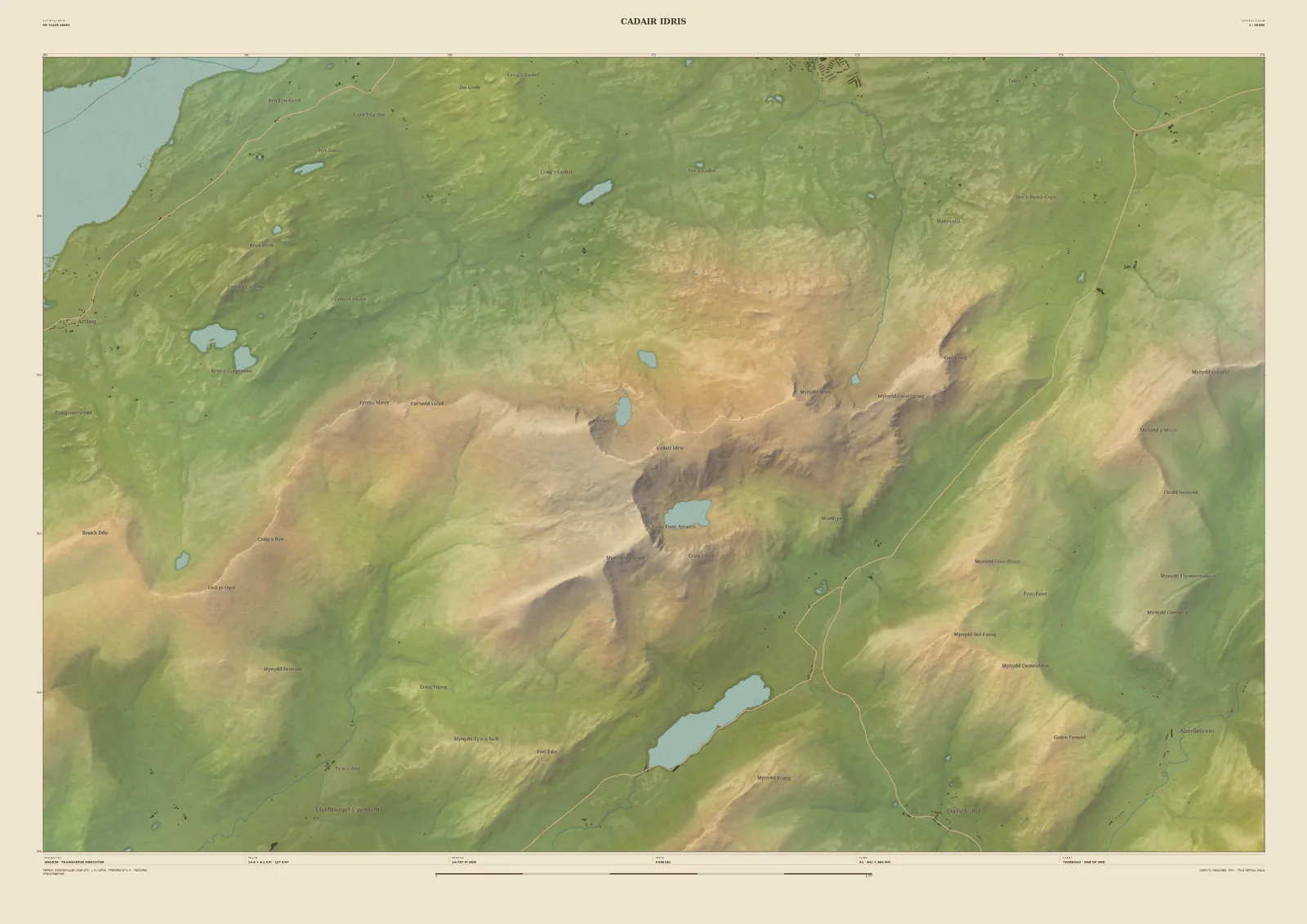
Cadair Idris relief map print
Llyn Cau, Tal-y-llyn and the Mawddach estuary
Cadair Idris rises steeply above the coast at the southern edge of Eryri. Its summit, Penygadair, sits above the deep cwm of Llyn Cau. On this frame the long ridge runs east to west, Tal-y-llyn Lake lies in the valley to the south-east, and the Mawddach estuary opens out in the north-west corner.
The terrain is from the Welsh Government’s 1-metre LiDAR, so the cliffs round Llyn Cau are drawn from measurement. It makes a good print for anyone who knows Dolgellau or the Minffordd path. Name the sheet after your own day on the mountain.
- Summit
- Penygadair, 893 m
- Frame
- 14 km across, centred on the summit. Move it, widen it or narrow it in the Studio.
- Terrain
- Welsh Government LiDAR 2020–23 · 1 m measured terrain (Wales)
- Style
- Field & Fell: soft earth colours, shaded hills, real water, and buildings where the scale allows
- Yours
- Your own title and words on the sheet. You see the finished preview before you pay.
- A2Rolled, to frame yourself£95
- A2Framed, ready to hang£185
- A1Rolled, to frame yourself£120
- A1Framed, ready to hang£250
- A0Rolled, to frame yourself£175
- A0Framed, ready to hang£375
Delivered prices. Printed to order on archival paper.