Bartholomew edition · England · close-up
The Malvern Hills
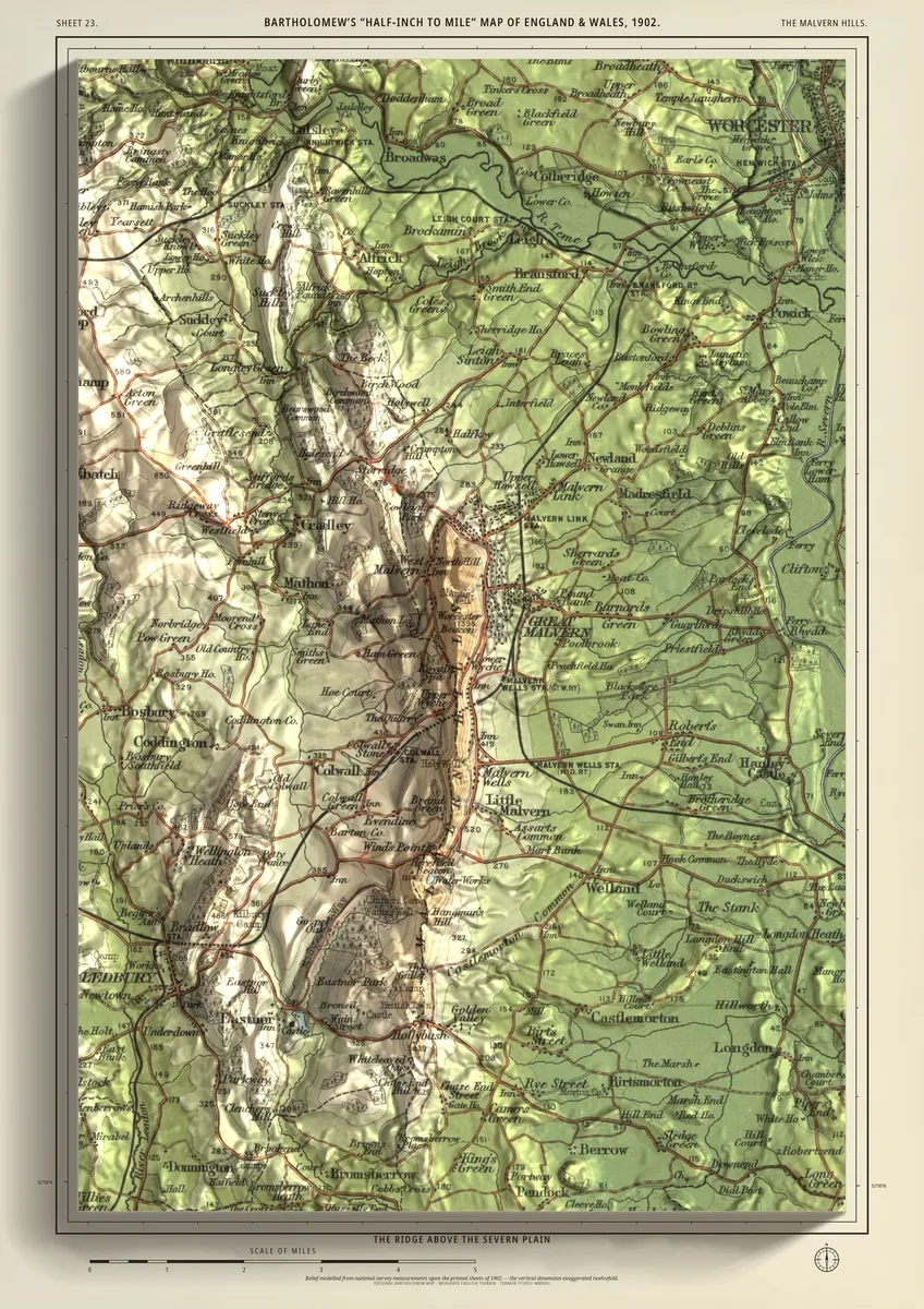
The ridge above the Severn plain
A close-up of the whole Malvern ridge, hung tall: from Great Malvern and the Worcestershire Beacon south past Malvern Wells and Little Malvern to British Camp on the Herefordshire Beacon. Colwall and Eastnor lie under the western side, Ledbury in the south-west corner, and to the east the land drops to the Severn plain.
- A2420 × 594 mmThe size it was designed for£95 rolled · £185 framed
Made for A2 only: the close-ups are drawn to be read at this size.
- From
- Bartholomew’s “Half-inch to mile” map, England & Wales sheet 23
- Printed
- 1902
- Scale
- Half an inch to the mile (1:126,720) on the original sheet
- Terrain
- Environment Agency LiDAR, height exaggerated about twelve times
- Giclée on archival paper, made to order. A flat print: the relief is light and shade.
- Edition
- Open, not numbered
Including UK delivery. You check your order on the next page before paying by card.