Bartholomew edition · Wales
Eryri
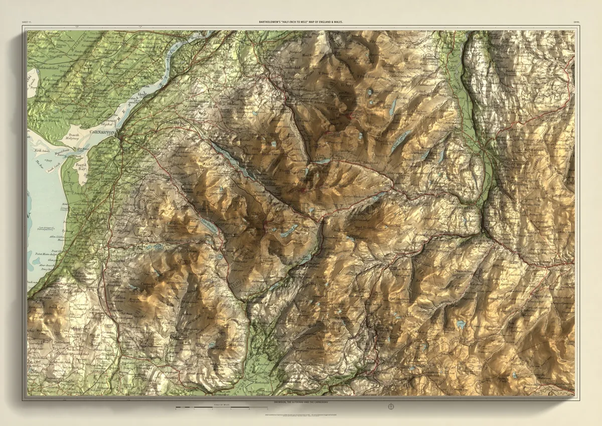
Snowdon, the Glyderau and the Carneddau
Snowdon and the ranges around it, with the Glyderau across the Llanberis pass to the north and the Carneddau beyond them. Llanberis and Llyn Padarn lie below the pass, Beddgelert, Capel Curig and Betws-y-Coed in the valleys, and Blaenau Ffestiniog in the south-east. On the western edge the land comes down to Caernarfon and the Menai Strait.
- A2594 × 420 mmThe same map, printed smaller£95 rolled · £185 framed
- A1841 × 594 mmThe same map, printed smaller£120 rolled · £250 framed
- A01189 × 841 mmThe size it was designed for£175 rolled only
Every size shows the whole 48 × 32 km. A smaller size is the same map printed smaller, made to order at that size.
- From
- Bartholomew’s “Half-inch to mile” map, England & Wales sheet 11
- Printed
- 1904
- Scale
- Half an inch to the mile (1:126,720) on the original sheet
- Terrain
- Copernicus GLO-30 satellite elevation, height exaggerated about twelve times
- Giclée on archival paper, made to order. A flat print: the relief is light and shade.
- Edition
- Open, not numbered
Including UK delivery. You check your order on the next page before paying by card.