Bartholomew edition · Scotland · close-up
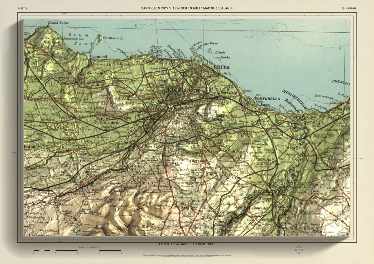
Edinburgh
Arthur's Seat and the Firth of Forth
A close-up of the city: the Castle on its rock, Arthur's Seat and Calton Hill, and the port of Leith on the Firth of Forth. The shore runs east through Portobello to Musselburgh and west to Cramond, and Blackford Hill and the Braid Hills rise in the south, with Dalkeith beyond.
- A2594 × 420 mmThe size it was designed for£95 rolled · £185 framed
Made for A2 only: the close-ups are drawn to be read at this size.
- From
- Bartholomew’s “Half-inch to mile” map, Scotland sheet 9
- Printed
- 1903
- Scale
- Half an inch to the mile (1:126,720) on the original sheet
- Terrain
- Copernicus GLO-30 satellite elevation, height exaggerated about twelve times
- Giclée on archival paper, made to order. A flat print: the relief is light and shade.
- Edition
- Open, not numbered
Including UK delivery. You check your order on the next page before paying by card.